
Map Multnomah County Neighbors by Parcel
For a block question, start with the seed address in SAIL, the County Tax District viewer, or PortlandMaps. Identify the exact parcel, then inspect the surrounding visible parcels. This produces a map of land and a path to recorded ownership evidence, not a complete list of neighbors. A property record can show an owner of record and mailing field, while a historic reverse directory can show a person or business listed at one address in one year. The difference matters when the goal is civic curiosity, a property question, or neighborhood history.
| Block source | What it can show nearby | Access and limit |
|---|---|---|
| Tax District and Map Image Viewer | Adjacent parcels, address and owner search modes, district and association layers | Free County map; owner data is not a household roster. |
| SAIL | Tax parcels, assessment maps, surveys, plats, legal-boundary clues | Free map and County Surveyor contact; it maps land evidence. |
| PortlandMaps | Address, nearby property context, neighborhood and permit context | City map for Portland addresses; source documents control. |
| Recorder / ART | Recorded party roles, owners, and historic instruments | Document chain through portal, counter, or request, not a block browser. |
| Reverse directories | Historical person or business listing at an address | 1930-forward address section; limited to the volume year. |
| Portland Civic Life | Association geography and public contact paths | Does not publish a citywide member roster. |
The County also has six incorporated cities plus unincorporated land. Portland civic geography should not be projected onto Gresham, Troutdale, Fairview, Wood Village, Maywood Park, or county land without checking the relevant local context. Note: Keep the map date and address version because boundaries and published directories describe specific points in time.
Multnomah County Block Map Tools
The Tax District and Map Image Viewer accepts owner name, property ID, property address, map page, and section searches. Its layers include detailed parcels, tax and transportation districts, school districts, neighborhood-association boundaries, urban-renewal areas, water, sewer, fire and soil districts, zoning, surveys, and plats. Those layers let a reader place an address in its recorded land and civic setting before looking for a specific document.
SAIL is the complementary County map. It searches address, tax lot, map number, plat name, and survey number and can help connect a visible parcel to an assessment map or legal description. The County Surveyor's map is useful for surveys and plat context, while the Tax District viewer is useful for adjacent-parcel and association-boundary context.
Portland planning maps provide additional official neighborhood, zoning, historic-resource, and boundary map routes for City addresses.
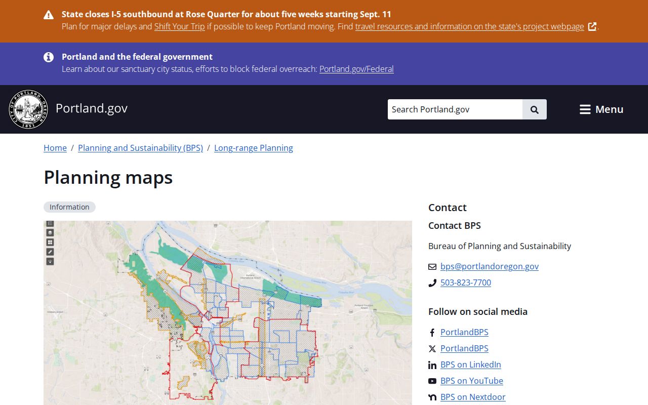
Planning maps add geography to a block inquiry, but they should be paired with the parcel map when an exact lot is involved.
Follow a Multnomah County Block Outward
Adjacent parcels should be checked as separate records. A clean workflow begins with a known address, confirms the parcel identifier, and only then moves to a neighboring lot. The output is stronger when it preserves the source and date for each parcel rather than collecting names without their record roles.
- Enter the seed address in SAIL or the Tax District viewer, then verify its property ID, situs address, map location, and legal-description context.
- Select only the adjoining parcels shown on the map. Record each property ID instead of assuming an address sequence follows one subdivision or tax-lot pattern.
- Use MultcoPropTax for the owner-of-record field and property facts. Keep the mailing address distinct from the situs address.
- If a recorded transfer matters, use the owner name, date, and document type in MultcoRecords. Capture the document number, party role, recording date, and legal description.
- For a prior block year, consult a reverse directory address by address. The volume gives a historical listing, not a present status.
For a whole named road rather than the immediate block, use the Multnomah County street directory workflow, which follows the full parcel and recorded-document chain by address.
Recorded Owners and Multnomah County Neighbors
A County property account identifies an owner of record, not every person who occupies an address. The owner may receive tax mail elsewhere. A Recorder result names a party in a document, and a directory entry reflects a publication's date and conventions. Each can be useful evidence for a carefully dated property or family-history question, but none is a complete current-household list.
| Official, dated record | Compiled neighbor category | Practical difference |
|---|---|---|
| Parcel map and property account | Mixed-source neighbor profile | The official record shows land and owner fields tied to a County source; a profile can merge stale or mismatched data. |
| Recorded instrument | Undated name list | The instrument supplies a recording date, party role, document number, and legal description. |
| Reverse directory volume | Claim about a current block | The directory preserves one historical publication year, not live occupancy. |
When records disagree, return to the office that created the record and retain the date. A geographic result can be persuasive without being personal identification.
Portland Associations Near Multnomah County Blocks
Portland Civic Life recognizes 94 neighborhood associations organized through four district coalition offices. For a Portland address, the City directs users to search the address in PortlandMaps and choose the neighborhood in the property pane. Association and City pages then provide public contact paths. For a multi-association contact list, Civic Life provides CivicLife@PortlandOregon.gov and 503-823-4519.
PortlandMaps neighborhood pane
Search a Portland address, then select the neighborhood in the property pane to identify the association geography.
Portland Civic Life
Recognizes the association system and provides public association-contact routes through City and neighborhood pages.
Other County communities
Use the applicable city or local association context for Gresham, Troutdale, Fairview, Wood Village, Maywood Park, and unincorporated areas.
Portland's neighborhood-system page explains the recognized-association route.
The association system supplies geography and voluntary public contacts, rather than a membership list for a block.
Voter Records Around Multnomah County Neighbors
Oregon My Vote is a secure self-service tool for a voter to check that voter's registration and ballot status. It is not a public name or address browser. Multnomah County Elections directs voters to the service for their own status and provides help at 503-988-8683. A public voter list follows a separate Secretary of State or county elections request process, with protected records and use restrictions.
No official source reviewed for this County provides a public registered-voter-by-block screen. An electronic statewide or less-than-statewide voter list is requested through the Secretary of State, while hardcopy partial lists and other non-electronic formats are requested from each county elections official represented. The published statewide electronic fee is $500; a less-than-statewide list has a $25 setup fee plus 2.5 cents per 100 records. That route does not turn an address into a current-residency certification, because list maintenance and confidentiality rules affect what appears.
Voter records may contain civic-registration fields under the statutory rules, but protected addresses, full birth date, Social Security number, driver-license information, and signatures have separate limits. A voter residence exemption can be requested with SEL 550 through the county clerk. A missing address may be a lawful safety protection.
Historic Multnomah County Neighbor Snapshots
For a historical block question, reverse directories are most useful from 1930 forward, when Portland volumes added the Street and Avenue Guide. Start with one address and one directory year. Before Portland's 1931 through 1933 address revision, resolve the older address first; the 1930 and 1931 volumes need the former form, while 1932 and 1933 may require both forms. The address change and the city's shifting municipal boundaries explain why a modern number can fail in an older source.
Portland City Archives, the Multnomah County Library house-history guidance, the Genealogical Forum of Oregon, and Oregon Historical Society collections are research channels for this dated layer. Their material can add a historical address context without making a claim about current neighbors.
Multnomah County Property Recording Alerts
The County's free Property Recording Alert Service is a preventive tool for recorded-document monitoring. It permits up to 10 party names per email address and sends an email when a document includes the monitored information. It does not index documents on the same day, prevent a recording, or determine legal validity. It is an alert to review a new recording with the Recorder, not a substitute for a title search or a way to track neighbors.
The service is useful when a property owner wants notice of a matching recording and plans to verify it through the official County record.
Privacy Limits for Multnomah County Neighbors
There is no official general-purpose resident browser for a block. Non-owner residents, family members, visitors, utility users, and delivery recipients are not established by parcel records. Address Confidentiality Program participants and qualifying voters can have protected address information, while Oregon safety exemptions and redactions protect other information. The Oregon Consumer Privacy Act and data-broker opt-out process concern covered private entities; they do not erase County Recorder, elections, or archive records.
Respect a redaction or omission. Do not turn a parcel map, civic boundary, voter-list process, or historic address book into a way to compile household rosters. Oregon's anti-stalking, harassment, and unlawful-disclosure laws remain relevant even when a source record is public.
Lawful use. Use block records for personal research, property history, civic context, and voluntary community contact. Never use them to stalk, harass, threaten, or harm another person.